TAG LOUISIANA
Website and Application Updates
taglouisiana.net
Overview
The Tag Program has been a great resource for gathering important and useful data from Anglers. We have made great progress last year and are working to continue improving the application and add new features for anglers and reports for administrators. These updates are essential to provide Anglers with an enjoyable user experience so they can continue providing data to improve understanding of marine sport fish movements, patterns of habitat use and interactions with the environment surrounding them.
Latest Improvements
- Simplified the new user registration process
- Decreased the chance of invalid data by adding validation checks
- Automated many administrative tasks to improve workflows
- Redesigned the public website and make it easier to navigate
- Integrate online store for TAG apparel for promotional purposes
What's up next
- Integrate text messaging and emailing into the application
- Link capture data to environmental data
- Implement machine learning to provide fish forecasts and analytics “Fish Almanac”
- Allowing Anglers to connect in real time through the dashboard with “Fish Friends”
- Use Artificial Intelligence to create a fish ID app
- Establish novel a offshore fishing tournament to streamline and improve data collection
- Introduce the “Fishing Professor” using real fish landing data to
Program Impact
Over 319,000 Fish Tagged
Over 14,400 Fish Recaptured
Over 3,500 Active Anglers
TAG Louisiana is driven by a sound marine sport fish tag and recapture program specifically designed to employ and educate anglers to improve our understanding of sport fish movements, patterns of habitat use and population dynamics.
New Angler Dashboard with Interactive Current Weather


The Angler dashboard is updated to be more user friendly and provides useful stats in a way that's more fun to look at and easier to consume. The new Angler dashboard also provides real time notifications and feedback on data they enter and allows them taggers to correct items on their own. Anglers get more insight into program data and their own captures at a glance, keeping them more engaged and returning to the application more often.
The Angler dashboard has also been updated to include interactive current weather conditions charts providing current Wind, Air Temperature, Water Temperature and Salinity. The angler can set a specific location for the weather charts to load and hover over the charts to view details.
Improved Capture Review
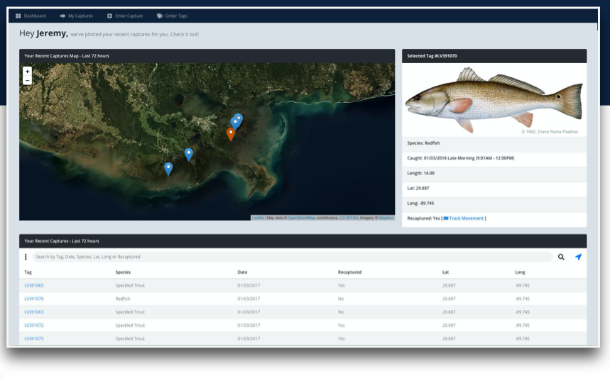
The review captures area provides a look at your most recent captures with the ability to easily search and filter results and load more captures into view if desired.
In this next phase we would like to add predefined species images and species information.
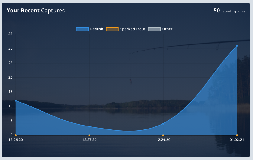
Interactive Charts and Graphs

Anglers get more insight into program data and their own captures at a glance, keeping them more engaged and returning to the application more often.
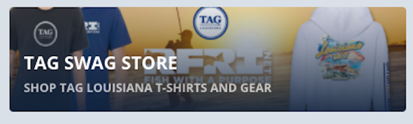
TAG SWAG Store

We have launched a TAG Louisiana online store with TAG T-Shirts and gear.
Integrated Email Newsletter
We have implemented email newsletter functionality to allow us to keep participants updated on the program, announcements and events. In addition we have built in functionality to allow for targeting messages to specific users that have completed specific actions over a period of time.
Sponsors and Promo Slots
We've added additional locations in the dashboard to for promotional banners and sponsor banners.
Administration Dashboard
The Admin dashboard serves as a tool to help Administrators stay on top of duties and tasks and get important program information at a glance. The improved workflow allows administrators to quickly access and perform administrative functions with minimal clicks.
Improved Data Validation
Feedback is given to the user when entering capture data and if invalid data is provided it provides a helpful message. Entering in a tag number that doesn’t exist will not be accepted. These additional validation checks before the data is accepted helps cut down and aims to eliminate the number of captures with errors.
Mobile Application
A cross-platform mobile app is being developed for Android and iOS. The existing desktop web application will continue to be enhanced to allow for additional features, edits of mobile captures, viewing of larger datasets, additional data filters as well as providing master logs and reporting functionality for program administrators.
Realtime Updates and Notifications
Anglers will be able to get realtime updates not only sent by text or email but also right in the dashboard. The system will also notify Anglers if it needs them to update or correct data.
Environmental Data
A new partnership will allow for linking capture data to environmental data during a particular trip, time of catch, and location. Collecting environmental data such as salinity, water depth, air temperature, etc. This allows users to maintain detailed fishing logs that document the environmental conditions that may have influenced their catch, allowing them for better planning for future trips.
Identification of Species using Machine Learning

We will produce an add-on to the mobile app platform that will automatically identify fish to the species level.
Many Gulf of Mexico fish are relatively simply to identify (i.e. Red Drum), whereas others like snapper and grouper can be challenging and accurate identification is critical for catch limits and quotas. The add-on would greatly benefit anglers and resear
Real-Time Biological Data
New levels of insight will help anglers understand why and how they caught fish. Easy to read data reports will not only provide every available environmental condition but will point anglers to areas of high sport fish concentrations or bait fish schools.
Using real-time data from Louisiana's La Creel surveys, the Fish Professor tells you what kinds of fish were caught, where and when. Users can limit their search to specific types of fish and can even hone in on precise fishing areas and marinas where fish were caught or landed.
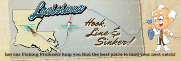
When planning for a trip a week or two away, the ‘Landings by Marina’ or the ‘Hot Zone’ map can help make fishing trip decisions and increase the odds of catching a targeted species.
Using the ‘Hot Zones’ feature, anglers can find out where fish have been biting in the past five days, 14 days, 30 days or in the previous year. The ‘Landings by Marina’ feature will help determine what marinas the fish landinged.
Fish Analytics and Fish Friends

Matching catches to local weather conditions will give anglers more insight to their captures. It will also allow them to look at forceasted conditions and predict potential fishing success.
They will be able to open a capture for more details to see environmental data matched to the date and time the capture was made and if they choose to, they can share and discuss it right in the application with fish friends.
Anglers can see what others using the app are catching and can stay in touch with fellow users, exchanging information about weather conditions, tides and what baits and techniques are working best.
Training Videos
We will be creating some updated videos on how to properly tag and useful tips on using the TAG website and application.
Sponsors & Advertising
We will add additional functionality that allows us to expand sponsorship opportunities. Giving users more than one choice of reward when meeting specific criteria. In addition, sponsor banners can be shown throughout the application and website based on sponsorship tier.